50 locations found

INDUSTRIAL PARK "FAIP" #00033
#brownfield, #industrial-park
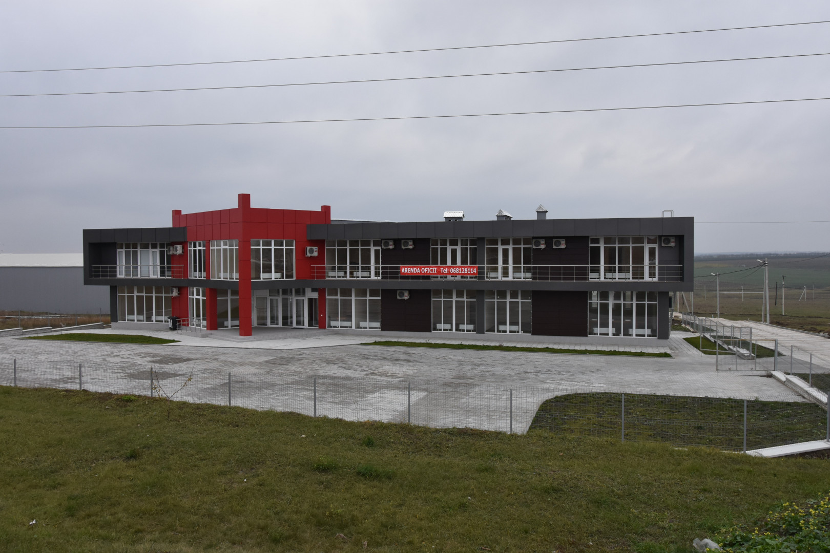
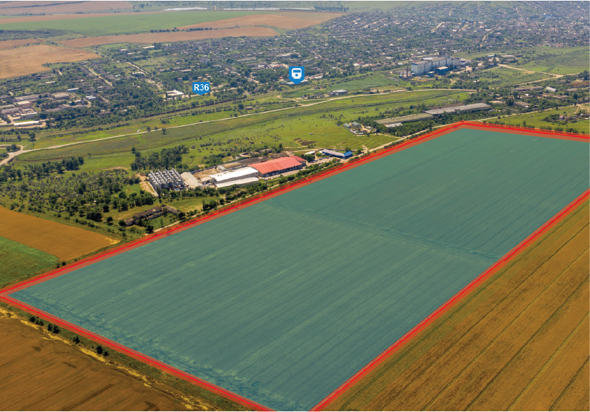
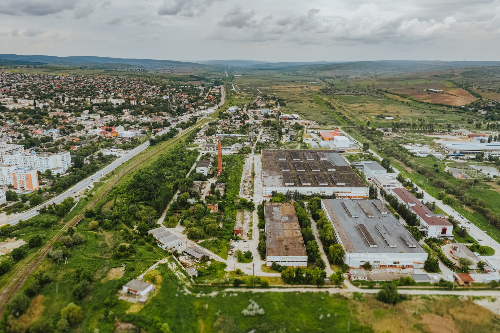
MULTI FUNCTIONAL INDUSTRIAL PLATFORM "OCNIȚA" #00044
#brownfield, #multifunctional-platform
| Location | Ocnita |
| Overall Population of the District | 47,425 inhabitants |
| Organizational Form | Multifunctional Industrial Platform |
| Land Ownership | Public |
| Free Buildable Area | 6.5 hectares |

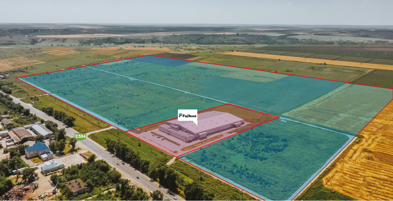
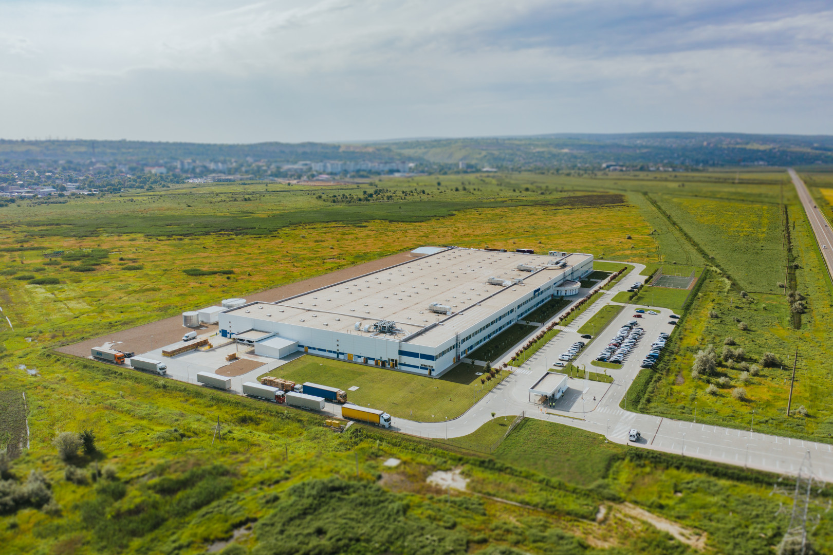
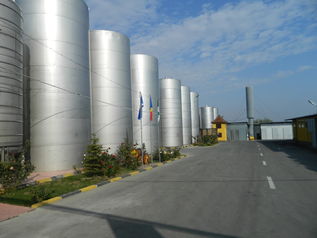
FREE ECONOMIC ZONE "Taraclia” #00073
FEZ “Taraclia” is located in immediate proximity to the City of Taraclia along the national road R38 connecting Vulcanesti – Cahul – Taraclia cities and railway connection Chisinau-Reni (UKR). The nearest border checkpoints with Ukraine is Mirnoe (MDA) – Tabachi (UKR) and Ciadir-Lunga (MDA) – Novie Troianai (UKR). Both border checkpoints are located at circa 30 km distance from Taraclia. Out of the total area of FEZ, the free buildable area is circa 25 hectares.
#greenfield, #free-economic-zone
| Location | Taraclia |
| Overall Population of District | 43,000 inhabitants |
| Total Area of the City | 34 km² |
| Organizational Form | FEZ administration |
| Land Ownership | Public |
| Free Buildable Area | 33 hectares |

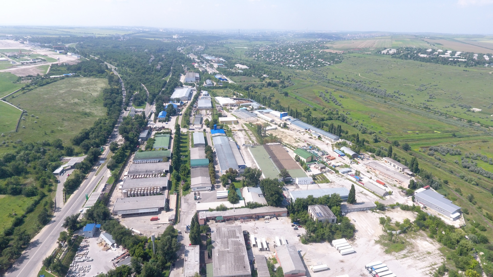
Ștefan Vodă #00079
The Subzone Ștefan Vodă is located in the city center. The Subzone’s land plot of 8.9 hectares has good access to National Route M30 connecting the District with Chișinău and leading down south to the two customs checkpoints with Ukraine (Palanca – Maiki-Udobnoe and Tudora – Starokazacie). The basic branches of District’s economy are represented by light industry (apparel), agri-food industry and services provision.
#greenfield, #free-economic-zone
| Location | Ștefan Vodă |
| Overall Population of the District | 70,200 inhabitants |
| Total Area of the City | 22.77 km² |
| Organizational Form | FEZ administration |
| Land Ownership | Public |
| Free Buildable Area | 8.9 hectares |

FREE ECONOMIC ZONE “BĂLȚI”
Zone type: Greenfield
Location: Bălți
Overall Population of the District: 150,700 inhabitants
Total Area of the City: 78 km²
Organizational Form: FEZ administration
Land Ownership: Public
Free Buildable Area: 90 hectares
INDUSTRIAL PARK "EDINEȚ"
Zone type: Brownfield
Location: Edinet
Overall population of the District: 79,200 inhabitants
Total area of the city: 5.7 km2
Organization Form: IP administration
Land Ownership: Public

Multifunctional Platform "Briceni"
Zone type: Brownfield
Zone population: 123.456 people

Hîncești
Zone type: Brownfield
Location: Hîncești
Overall Population of the District: 119,200 Inhabitants
Total Area of the City: 1.484 km²
Organizational Form: FEZ administration
Land Ownership: Private
Land Area: 1.99 hectares

Crihana Veche (Cahul)
Zone type: Greenfield
Location: Cahul
Overall Population of the Distric: 125,000 inhabitants
Total Area of the City: 34 km²
Organizational Form: FEZ administration
Land Ownership: Public
Free Buildable Area: 23 hectares

Sîngera
Zone type: Brownfield
Location: Sîngera
Overall Population of the District: 90,000 inhabitants
Total Area of the City: 8 km²
Organizational Form: FEZ administration
Land Ownership: Private
Free Buildable Area: 15,9 hectares
Comrat Subzone 1
Zone type: Greenfield
Location: Comrat Municipality
Overall Population of the Autonomy: 150,000 inhabitants
Total Area of the City: 17 km²
Organizational Form: FEZ administration
Land Ownership: Public
Free Buildable Area: 40 hectares

FREE ECONOMIC ZONE "OTACI-BUSINESS”
Zone type: Brownfield
Location: Otaci
Overall Population of the Distric: 9,000 inhabitants
Total Area of the City: 3.7 km²
Organizational Form: FEZ administration
Land Ownership: Public
Free Buildable Area: 30 hectares
INDUSTRIAL PARK "TRACOM"
Zone type: Brownfield
Location: Chisinau
Overall Population of the District: 820,500 inhabitants
Total Area of the City: 576.1 km²
Organizational Form: IP administration
Land Ownership: Public\/Private
MULTI FUNCTIONAL INDUSTRIAL PLATFORM "ANENII NOI"
Zone type: Brownfield
Location: Anenii Noi
Overall Population of the District: 78,900 inhabitants
Organizational Form: Multifunctional Industrial Platform
Land Ownership: Public
Free Buildable Area: 12.2 hectares

Nisporeni
Zone type: Greenfield
Location: Nisporeni
Overall Population of the District: 65,400 Inhabitants
Total Area of the City: 14 km²
Organizational Form: FEZ administration
Land Ownership: Private
Land Area: 23.7 hectares

Căușeni
Zone type: Greenfield
Location: Căușeni
Overall Population of the District: 90,500 inhabitants
Total Area of the City: 10 km²
Organizational Form: FEZ administration
Land Ownership: Private \/ Public
Free Buildable Area: 5.5 hectares
Comrat Subzone 2
Zone type: Brownfield
Location: Comrat Municipality
Overall Population of the Autonomy: 150,000 inhabitants
Total Area of the City: 17 km²
Organizational Form: FEZ administration
Land Ownership: Public

FREE ECONOMIC ZONE "UNGHENI-BUSINESS”
Zone type: Brownfield
Location: Ungheni
Overall Population of District: 117,100 Inhabitants
Total Area of the City: 16.4 km2
Organizational Form: FEZ administration
Land Ownership: Private
Free Buildable area: 5.15 hectares
Subzones

INDUSTRIAL PARK "COMRAT"
Zone type: Brownfield
Location: Comrat Municipality
Overall Population of the Autonomy: 150,000 inhabitants
Total Area of the City: 17 km²
Organizational Form: Municipal Enterprise
Land Ownership: Public
Free Buildable Area: 40 hectares
MULTI FUNCTIONAL INDUSTRIAL PLATFORM "CANTEMIR"
Zone type: Brownfield
Location: Cantemir
Overall Population of the District: 52,115 inhabitants
Organizational Form: Multifunctional Industrial Platform
Land Ownership: Public
Free Buildable Area: 5.97 hectares

Tuzara (Călărași)
Zone type: Greenfield
Location: Tuzara (Călărași)
Overall Population of the District: 77,300 Inhabitants
Total Area of the City: 42.33 km²
Organizational Form: FEZ administration
Land Ownership: Public
Land Area: 32.27 hectares
Ceadir-Lunga
Zone type: Greenfield
Location: Ceadîr-Lunga
Overall Population of the Autonomy: 150.000 Inhabitants
Total Area of the City: 9.6 km2
Organizational Form: FEZ administration
Land Ownership: Public
Land Area: 42 hectares
Orhei
Zone type: Brownfield
Location: Orhei
Overall Population of the District: 25,000 inhabitants
Total Area of the City: 8,5 km²
Organizational Form: FEZ administration
Land Ownership: Public
Free Buildable Area: 8 hectares, with possibility to extend up to 170 hectares
FREE ECONOMIC ZONE "EXPO BUSINESS CHIȘINĂU”
Zone type: Brownfield
Location: Chisinau
Overall Population of the District: 820,500 inhabitants
Total Area of the City: 576.1 km²
Organizational Form: FEZ administration
Land Ownership: Public\/Private
Free Buildable Area: 15 hectares
Subzones
MULTI FUNCTIONAL INDUSTRIAL PLATFORM "FLOREȘITI"
Zone type: Brownfield
Location: Floresti
Overall Population of the District: 76,460 inhabitants
Total Area of the City: 15.12 km²
Organizational Form: Multifunctional Industrial Platform
Land Ownership: Public
Free Buildable Area: 61.2 hectares

Soroca
Zone type: Greenfield
Location: Soroca
Overall Population of the District: 100,000 Inhabitants
Total Area of the City: 11.88 km2
Organizational Form: FEZ administration
Land Ownership: Public
Total Free Buildable Area: 17.6 hectares

Pănășești
Zone type: Greenfield
Location: Panasesti
Overall Population of the Distric: 92,000 inhabitants
Total Area of the City: 8 km²
Organizational Form: FEZ administration
Land Ownership: Public
Free Buildable Area: 8,7 hectares
INDUSTRIAL PARK "CIMIȘLIA"
Zone type: Greenfield
Location: Cimișlia
Overall Population of the District: 59,200 inhabitants
Total Area of the City: 20.84 km2
Organizational Form: IP administration
Land Ownership: Public
Free Buildable Area: 39.5 ha

FREE ECONOMIC ZONE "VALKANEȘ”
Zone type: Brownfield
Location: Vulcanesti
Overall Population of the District: 150,000 inhabitants
Total Area of the City: 15.26 km²
Organizational Form: FEZ administration
Land Ownership: Public
Free Buildable Area: 107 hectares
MULTI FUNCTIONAL INDUSTRIAL PLATFORM "IALOVENI"
Zone type: Brownfield
Location: Ialoveni
Overall Population of the District: 93,154 inhabitants
Total Area of the City: 31.6 km²
Organizational Form: Multifunctional Industrial Platform
Land Ownership: Public
Free Buildable Area: 6.5 hectares

INDUSTRIAL PARK "CAAN"
Zone type: Brownfield
Location: Strășeni
Overall Population of the District: 92,400 inhabitants
Total Area of the City: 15 km²
Organizational Form: IP administration
Land Ownership: Private
Total Free Production Premises: 56,000 m2

Rezina
Zone type: Brownfield
Location: Rezina
Overall Population of the District: 18,000 inhabitants
Total Area of the City: 622 km²
Organizational Form: FEZ administration
Land Ownership: Public
Free Production Premises: 20,000 sq.m.
Land Area: 8.7 hectares
FREE ECONOMIC ZONE "TVARDIȚA”
Zone type: Brownfield
Location: Tvardita
Overall Population of the Distric: 43,000 inhabitants
Total Area of the City: 81.5 km²
Organizational Form: FEZ administration
Land Ownership: Public
Free Buildable Area: 3,57 hectares

INDUSTRIAL PARK "CAHUL"
Zone type: Brownfield
Location: Cahul
Overall Population of the Distric: 125,000 inhabitants
Total Area of the City: 34 km²
Organizational Form: IP administration
Land Ownership: Public
Free Buildable Area: 23 hectares
MULTI FUNCTIONAL INDUSTRIAL PLATFORM "LEOVA"
Zone type: Brownfield
Location: Leova
Overall Population of the District: 53,800 inhabitants
Organizational Form: Multifunctional Industrial Platform
Land Ownership: Public
Free Buildable Area: 10 hectares
Strășeni
Zone type: Brownfield
Location: Strășeni
Overall Population of the District: 92,400 inhabitants
Total Area of the City: 15 km²
Organizational Form: FEZ administration
Land Ownership: Private
Total Free Production Premises: 56,000 m2
Free Buildable Area: 15 hectares
MULTI FUNCTIONAL INDUSTRIAL PLATFORM "OCNIȚA"
Zone type: Brownfield
Location: Ocnita
Overall Population of the District: 47,425 inhabitants
Organizational Form: Multifunctional Industrial Platform
Land Ownership: Public
Free Buildable Area: 6.5 hectares
FREE ECONOMIC ZONE "Taraclia”
Zone type: Greenfield
Location: Taraclia
Overall Population of District: 43,000 inhabitants
Total Area of the City: 34 km²
Organizational Form: FEZ administration
Land Ownership: Public
Free Buildable Area: 33 hectares
Ștefan Vodă
Zone type: Greenfield
Location: Ștefan Vodă
Overall Population of the District: 70,200 inhabitants
Total Area of the City: 22.77 km²
Organizational Form: FEZ administration
Land Ownership: Public
Free Buildable Area: 8.9 hectares

INDUSTRIAL PARK "LA TRIVINETA CAVI"
Zone type: Brownfield
Location: Strășeni
Overall Population of the District: 92,400 inhabitants
Total Area of the City: 15 km²
Organizational Form: IP administration
Land Ownership: Private
MULTI FUNCTIONAL INDUSTRIAL PLATFORM "RÎȘCANI"
Zone type: Brownfield
Location: Riscani
Overall Population of the District: 59,226 inhabitants
Total Area of the City: 5.83 km²
Organizational Form: Multifunctional Industrial Platform
Land Ownership: Public
Free Buildable Area: 21.7 hectares
MULTI FUNCTIONAL INDUSTRIAL PLATFORM "SÎNGEREI"
Zone type: Brownfield
Location: Ialoveni
Overall Population of the District: 79,814 inhabitants
Organizational Form: Multifunctional Industrial Platform
Land Ownership: Public
Free Buildable Area: 7 hectares


INDUSTRIAL PARK "RĂUT"
Zone type: Brownfield
Location: Bălți
Overall Population of the District: 150,700 inhabitants
Total Area of the City: 78 km²
Organizational Form: IP administration
Land Ownership: Public
Free Buildable Area: 90 hectares
MULTI FUNCTIONAL INDUSTRIAL PLATFORM "ȘOLDĂNEȘTI"
Zone type: Brownfield
Location: Soldanesti
Overall Population of the District: 36,743 inhabitants
Organizational Form: Multifunctional Industrial Platform
Land Ownership: Public
Free Buildable Area: 21 hectares
MULTI FUNCTIONAL INDUSTRIAL PLATFORM "TELENEȘTI"
Zone type: Brownfield
Location: Telenesti
Overall Population of the District: 61,144 inhabitants
Total Area of the City: 31.6 km²
Organizational Form: Multifunctional Industrial Platform
Land Ownership: Public
Free Buildable Area: 10 hectares
MULTI FUNCTIONAL INDUSTRIAL PLATFORM "BASARABEASCA"
Zone type: Brownfield

MULTI FUNCTIONAL INDUSTRIAL PLATFORM "GLODENI"
Zone type: Brownfield
Location: Glodeni
Overall Population of the District: 51,306 inhabitants
Organizational Form: Multifunctional Industrial Platform
Land Ownership: Public
Free Buildable Area: 6.2 hectares

Multifunctional Platform "Ceadîr Lunga"
Zone type: Brownfield
Location: Ceadîr-Lunga
Overall Population of the Autonomy: 150.000 Inhabitants
Total Area of the City: 9.6 km2
Organizational Form: Ceadir-Lunga Municipality
Land Ownership: Public
Land Area: 7 hectares
Multifunctional Platform "Cimișlia"
Zone type: Brownfield
Location: Ialoveni
Overall Population of the District: 49,299 inhabitants
Organizational Form: Multifunctional Industrial Platform
Land Ownership: Public
Free Buildable Area: 10 hectares
Multifunctional Platform "Dondușeni"
Zone type: Brownfield
Location: Donduseni
Overall Population of the District: 37,856 inhabitants
Organizational Form: Multifunctional Industrial Platform
Land Ownership: Public
Free Buildable Area: 24.4 hectares

Soroca
Zone type: Brownfield
Location: Soroca
Overall Population of the District: 100,000 Inhabitants
Total Area of the City: 11.88 km2
Organizational Form: FEZ administration
Land Ownership: Public

FREE ECONOMIC ZONE "VALKANEȘ”
Zone type: Greenfield
Location: Vulcanesti
Overall Population of the District: 150,000 inhabitants
Total Area of the City: 15.26 km²
Organizational Form: FEZ administration
Land Ownership: Public
Free Buildable Area: 107 hectares

INDUSTRIAL PARK "COMRAT"
Zone type: Greenfield
Location: Comrat Municipality
Overall Population of the Autonomy: 150,000 inhabitants
Total Area of the City: 17 km²
Organizational Form: Municipal Enterprise
Land Ownership: Public
Free Buildable Area: 40 hectares

Multifunctional Platform "Ceadîr Lunga"
Zone type: Greenfield
Location: Ceadîr-Lunga
Overall Population of the Autonomy: 150.000 Inhabitants
Total Area of the City: 9.6 km2
Organizational Form: Ceadir-Lunga Municipality
Land Ownership: Public
Land Area: 7 hectares

INDUSTRIAL PARK "EDINEȚ"
Zone type: Greenfield
Location: Edinet
Overall population of the District: 79,200 inhabitants
Total area of the city: 5.7 km2
Organization Form: IP administration
Land Ownership: Public
Free Buildable Area: 5 hectares

INDUSTRIAL PARK "TRACOM"
Zone type: Greenfield
Location: Chisinau
Overall Population of the District: 820,500 inhabitants
Total Area of the City: 576.1 km²
Organizational Form: IP administration
Land Ownership: Public\/Private

Crihana Veche (Cahul)
Zone type: Brownfield
Location: Cahul
Overall Population of the Distric: 125,000 inhabitants
Total Area of the City: 34 km²
Organizational Form: FEZ administration
Land Ownership: Private

FREE ECONOMIC ZONE “BĂLȚI”
Zone type: Brownfield
Location: Bălți
Overall Population of the District: 150,700 inhabitants
Total Area of the City: 78 km²
Organizational Form: FEZ administration
Land Ownership: Public
Free Buildable Area: 90 hectares